
.. Quick Links ..
Testimony
Editorials
Petitions
Sealaska Exposed
More Pictures
Maps
.. Our Towns ..
Edna Bay
Port Protection
Point Baker
Cape Pole
Naukati
Hollis
Kupreanof
Whale Pass
Thorne Bay
... EXCLUSIVE MAPS ...
Sealaska Bills Created In-holdings Called Future, Historic, and Energy
Yakutat, below, is board member Byron Mallott's home.
In the upper left corner is an island where his sister built a cabin that resulted in the U.S. Attorney filing in Federal court (pp 3-4) to have it removed.
Only Sealaska choosing this 48 acre island [19/D/48 on the map] as a future site prevented the cabin from being removed.
This appears to be Crony Capitalism at work, because the Corporation's legislation before Congress benefits the family of one board member who just happened to raise $2,000,000 for Senator Murkowski's campaign.
For years Murkowski included the island in different versions of the bill which to this day has kept the cabin from being destroyed. This year we expect the island will again be included.
The illegal cabin that Mallot's sister built on 50 acre Eleanor Island still stands despite court action and USFS orders to remove it. The VP of Sealaska Corporation intervened, Crony Capitalism at its best.
What Are ANCSA Boxes?
They are the nine townships - 23,040 acres for each township - around each of 8 native villages in Southeast Alaska.
The President of Sealaska requested the location of these boxes when he appeared before Congress in 1975.
Each red box surrounds at least one village.
Note that the dark pink is owned by Sealaska Corporation and the light pink is owned by village corporations.
Look at the box in the upper left hand corner for Yakutat. Sealaska board member Byron Mallot lives there. He has been on the board for decades and Sealaska has selected no land to log there.
Look at the box in the middle for Angoon. Albert Kookesh, who has also been on the board for decades, lives there. Sealaska selected no land on Admiralty Island next to Angoon.
Look at center top of the map for the village of Klukwan. Two Sealaska board members live there, Rosita Wrol and Bill Thomas. Klukwan took all of their selection from the best timber in Alaska on Long Island 300 miles away.
Could it be that the corporate kings and queens of Sealaska don't want logging in their back yard?
SOURCE: Sealaska Corporation.
The Southernmost island in the above map is called Prince Of Wales Island.
Our island is 120 miles long, out nations 3rd largest.
Because it is so big we have had to split it in two below.
The ANCSA boxes on this map are white.
THE WHITE BOXES ARE MOSTLY THE SEALASKA AND VILLAGE CORPORATION LANDS.
CLICK ON THESE TWO MAPS FOR PRINCE OF WALES ISLAND.
THE LEFT MAP IS THE NORTHERN HALF OF PRINCE OF WALES, THE RIGHT IS THE SOUTHERN HALF. THE ISLAND IS 120 MILES LONG, OUR NATIONS 3RD LARGEST.
SOURCE: USFS
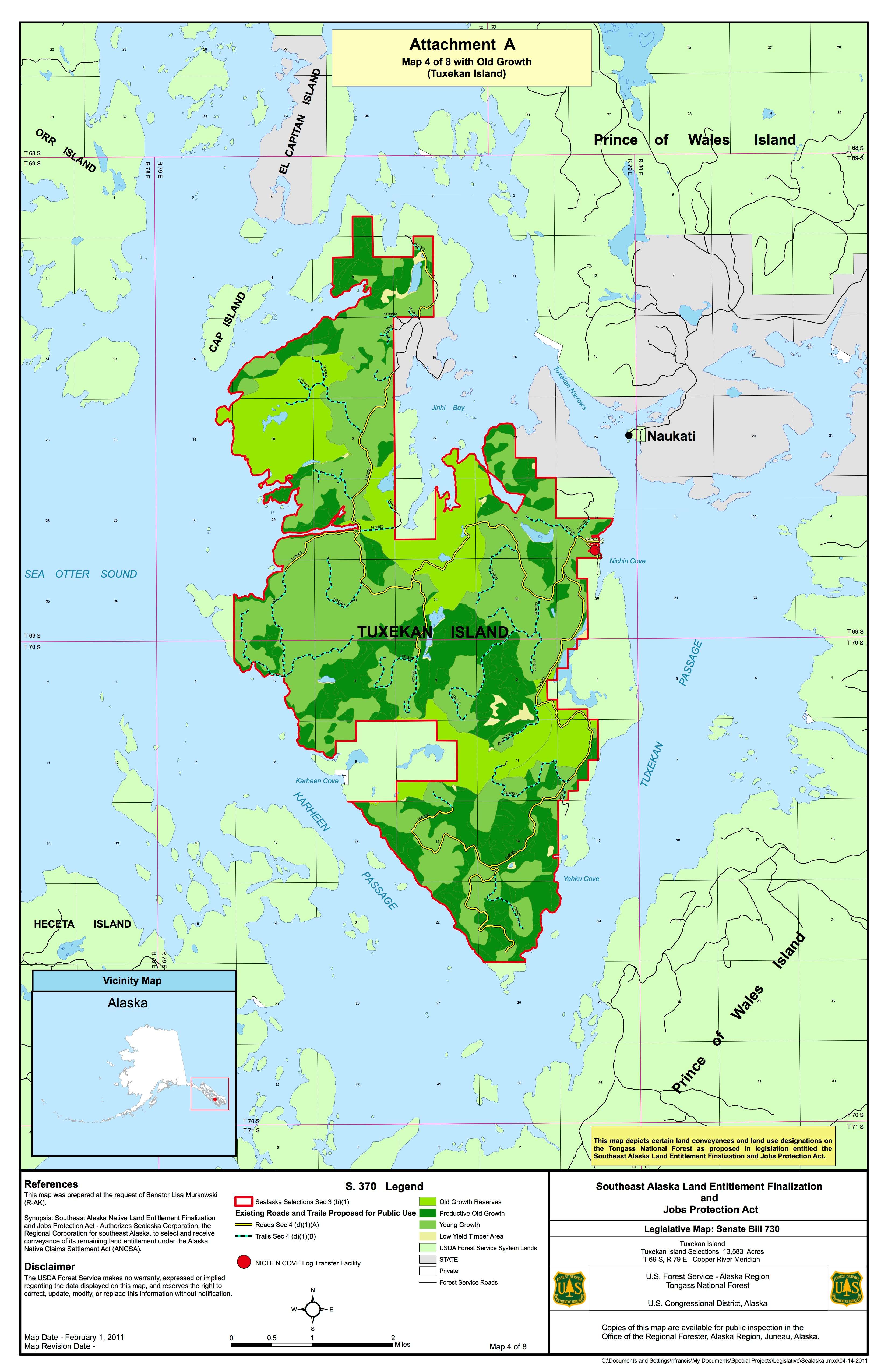
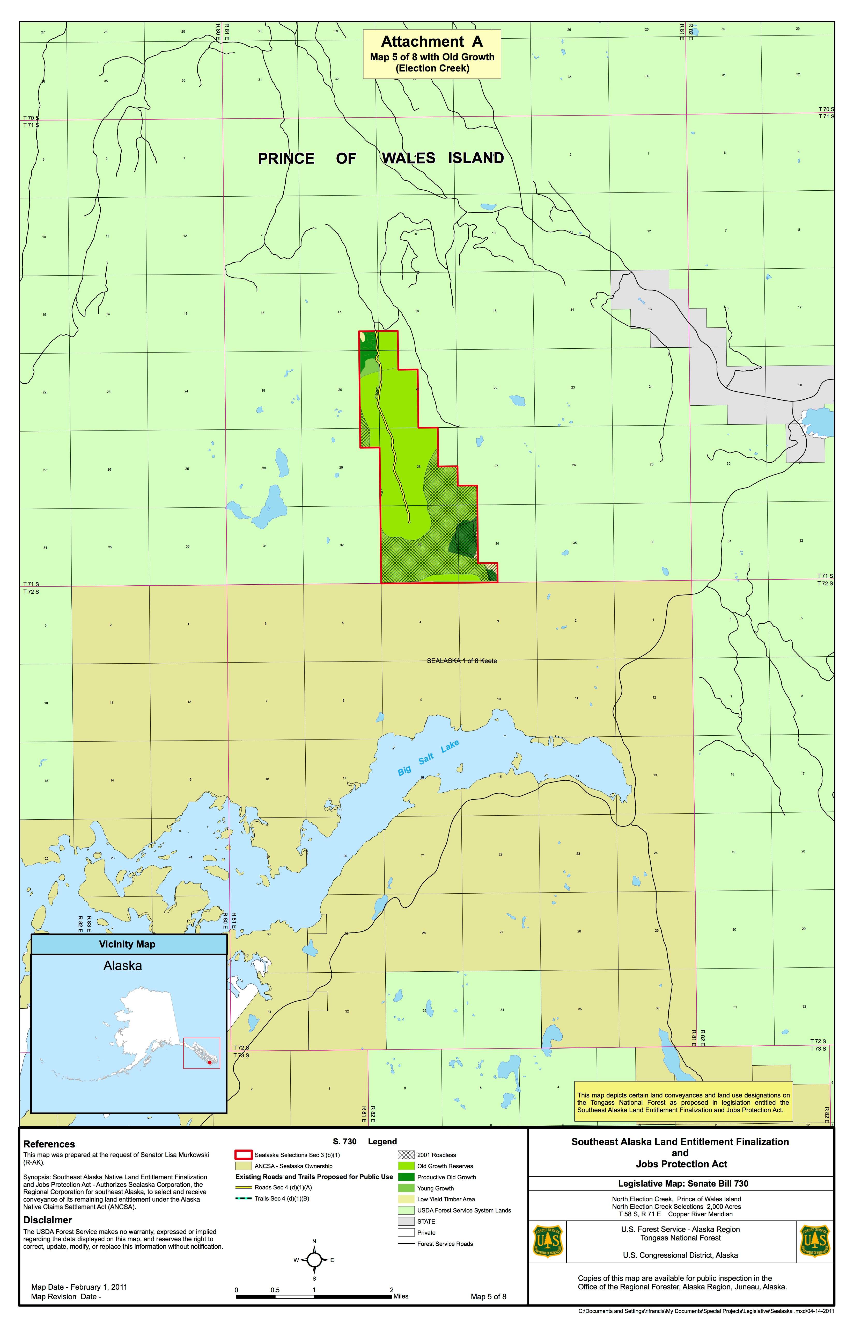
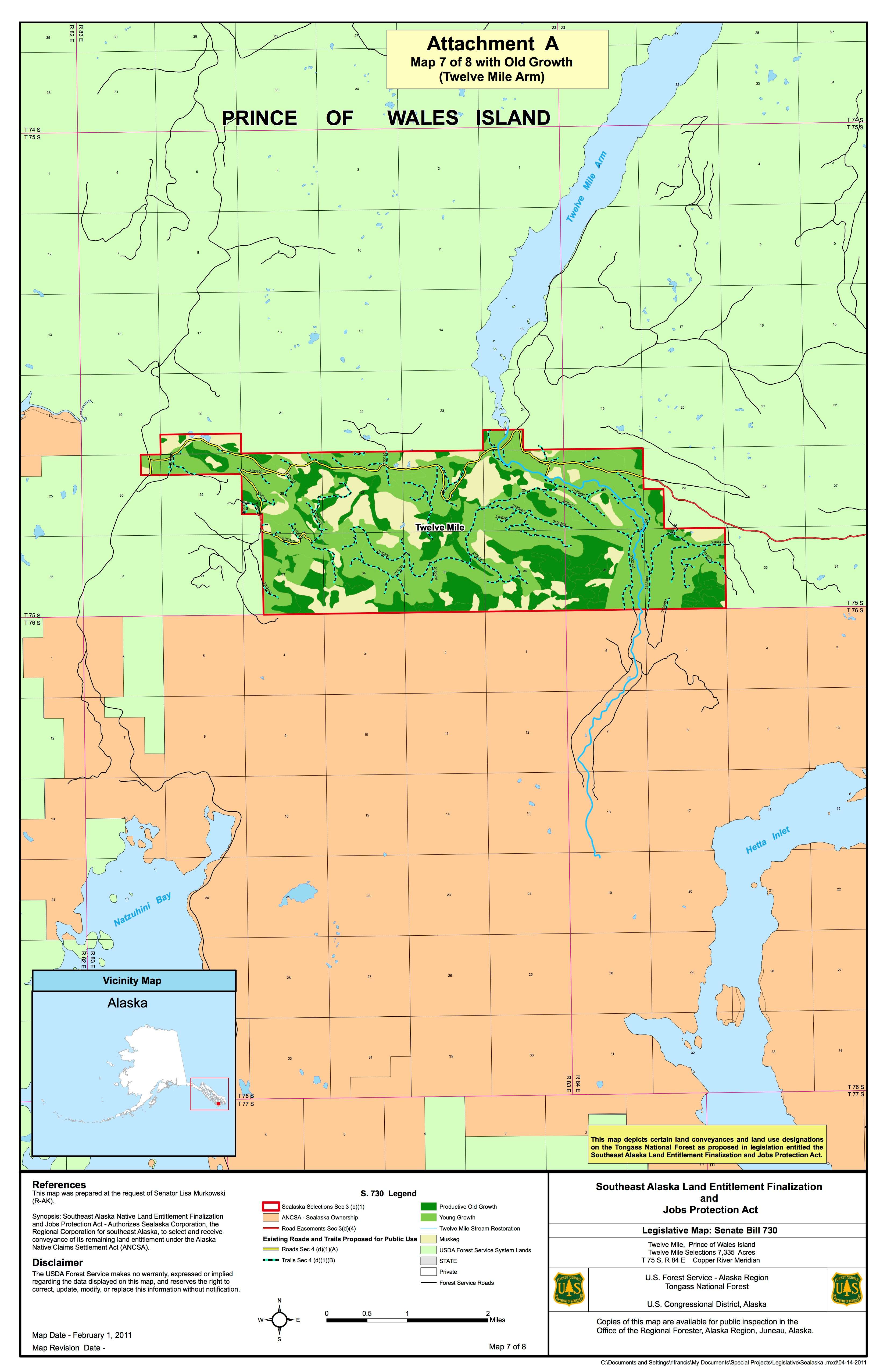
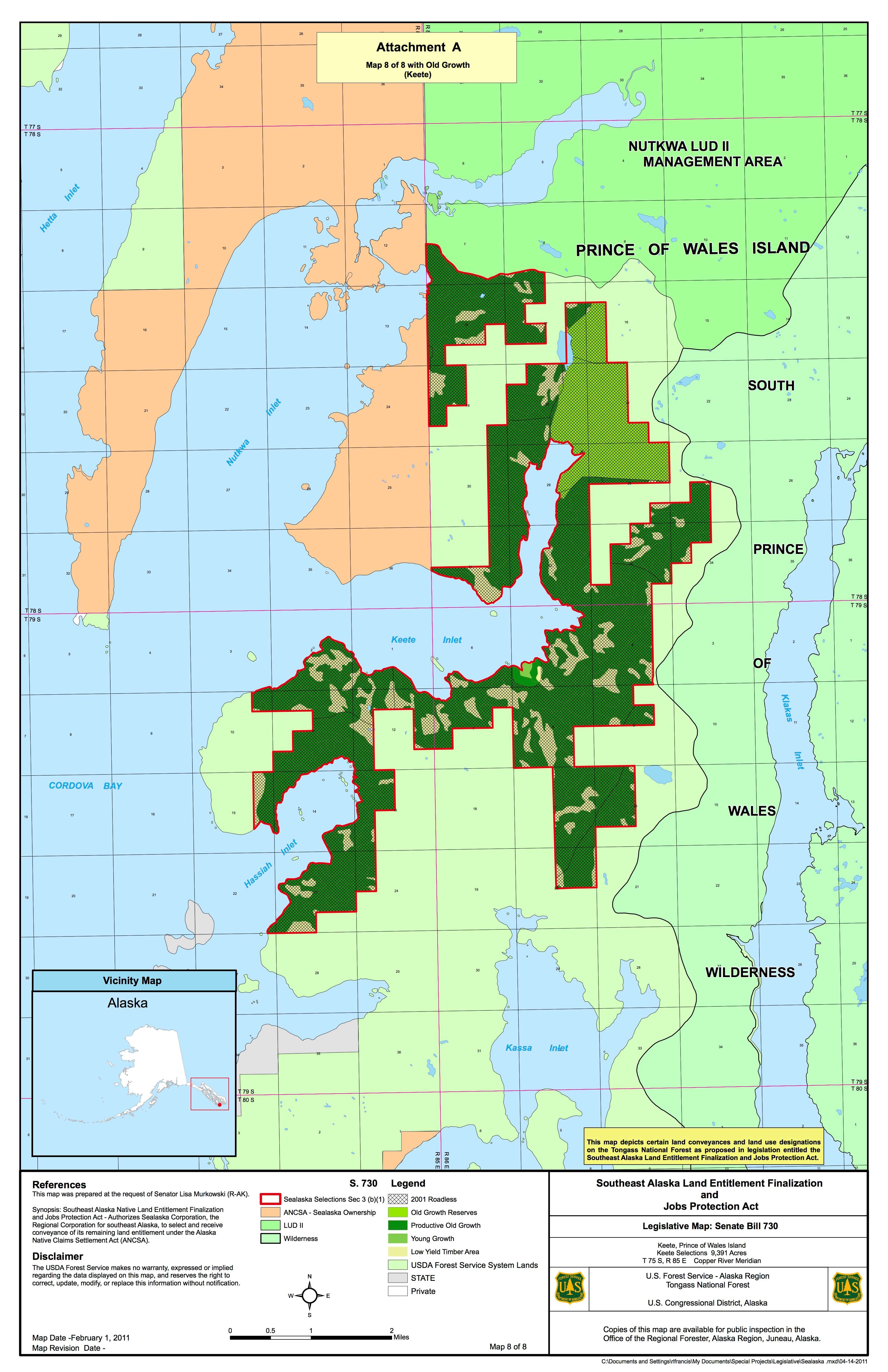
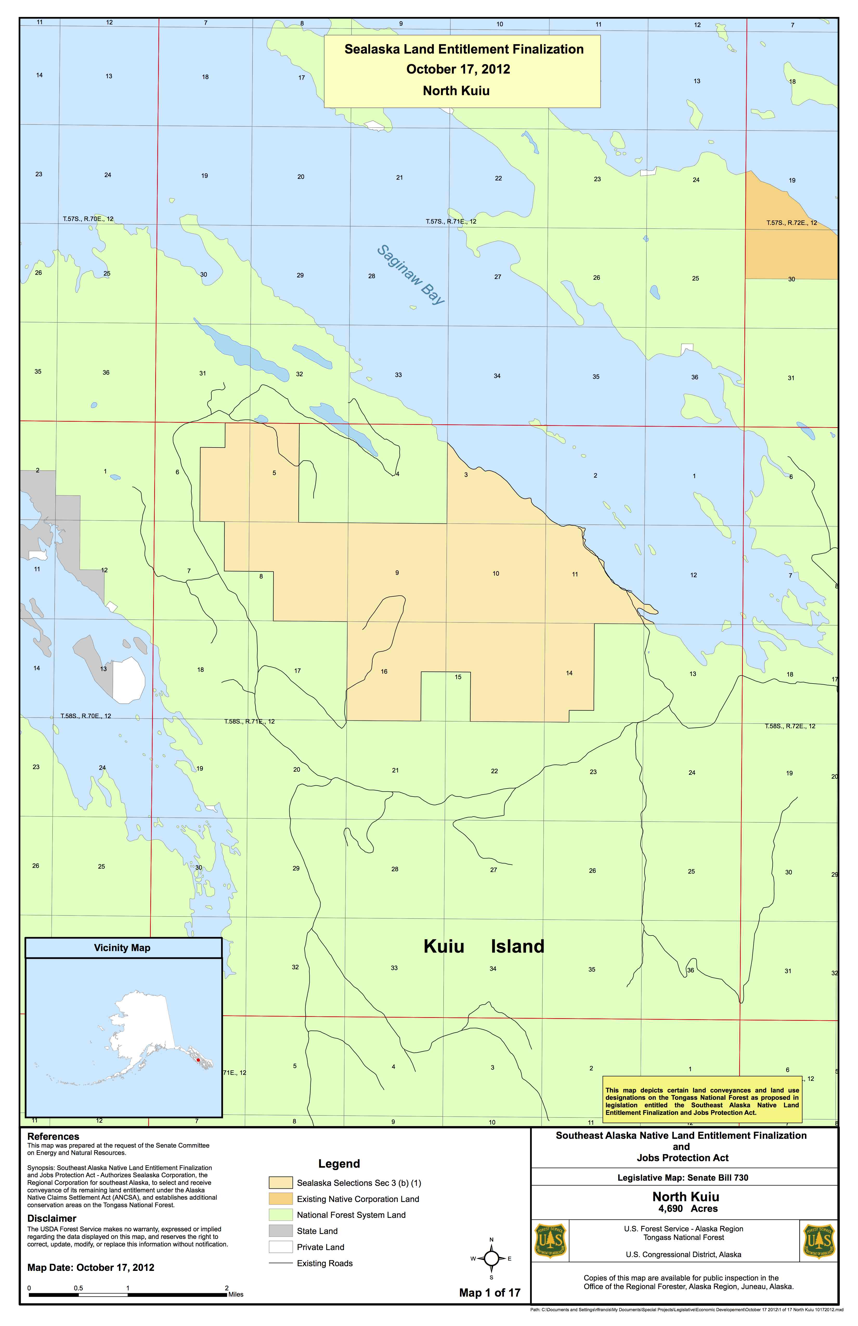
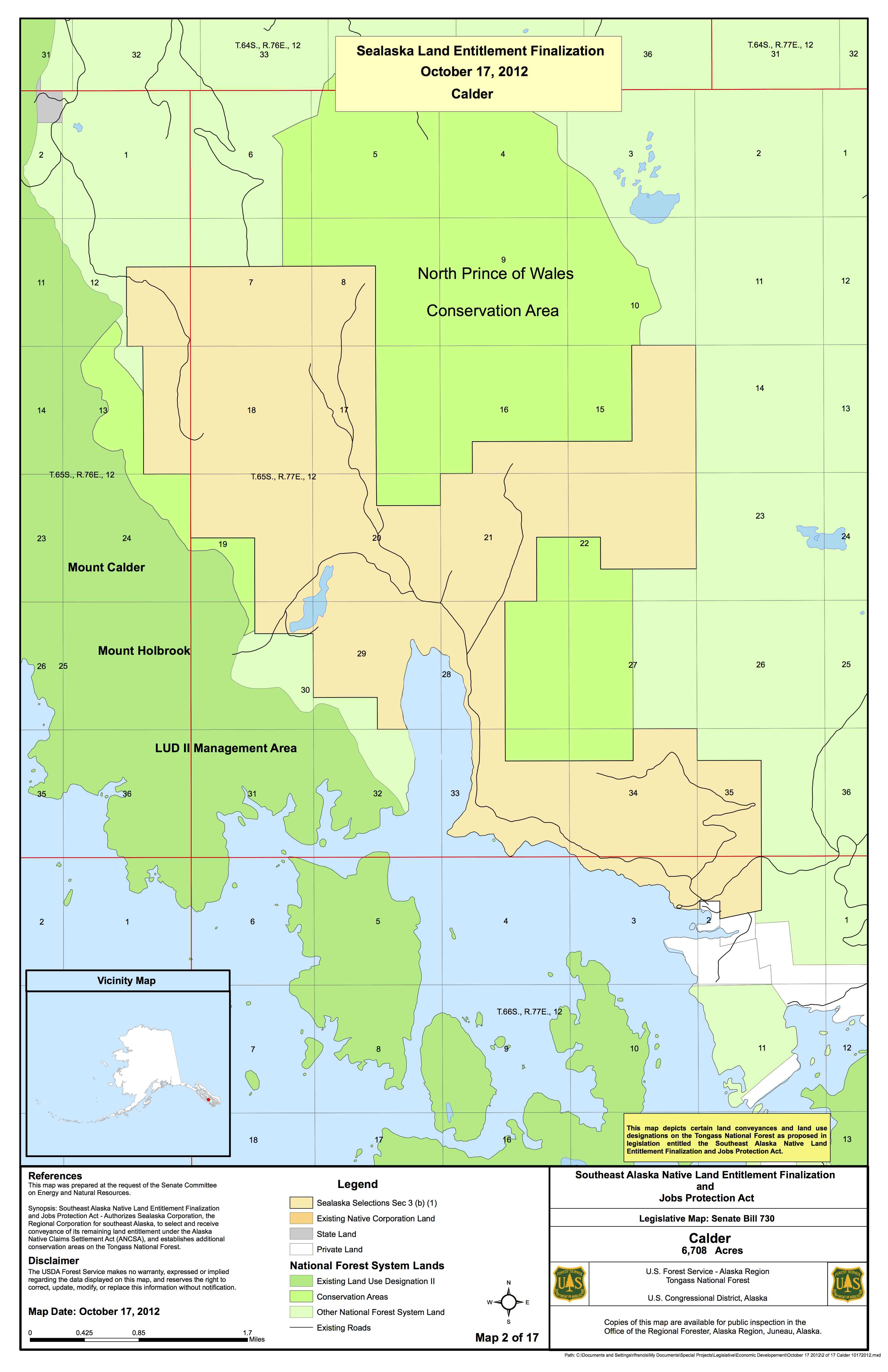
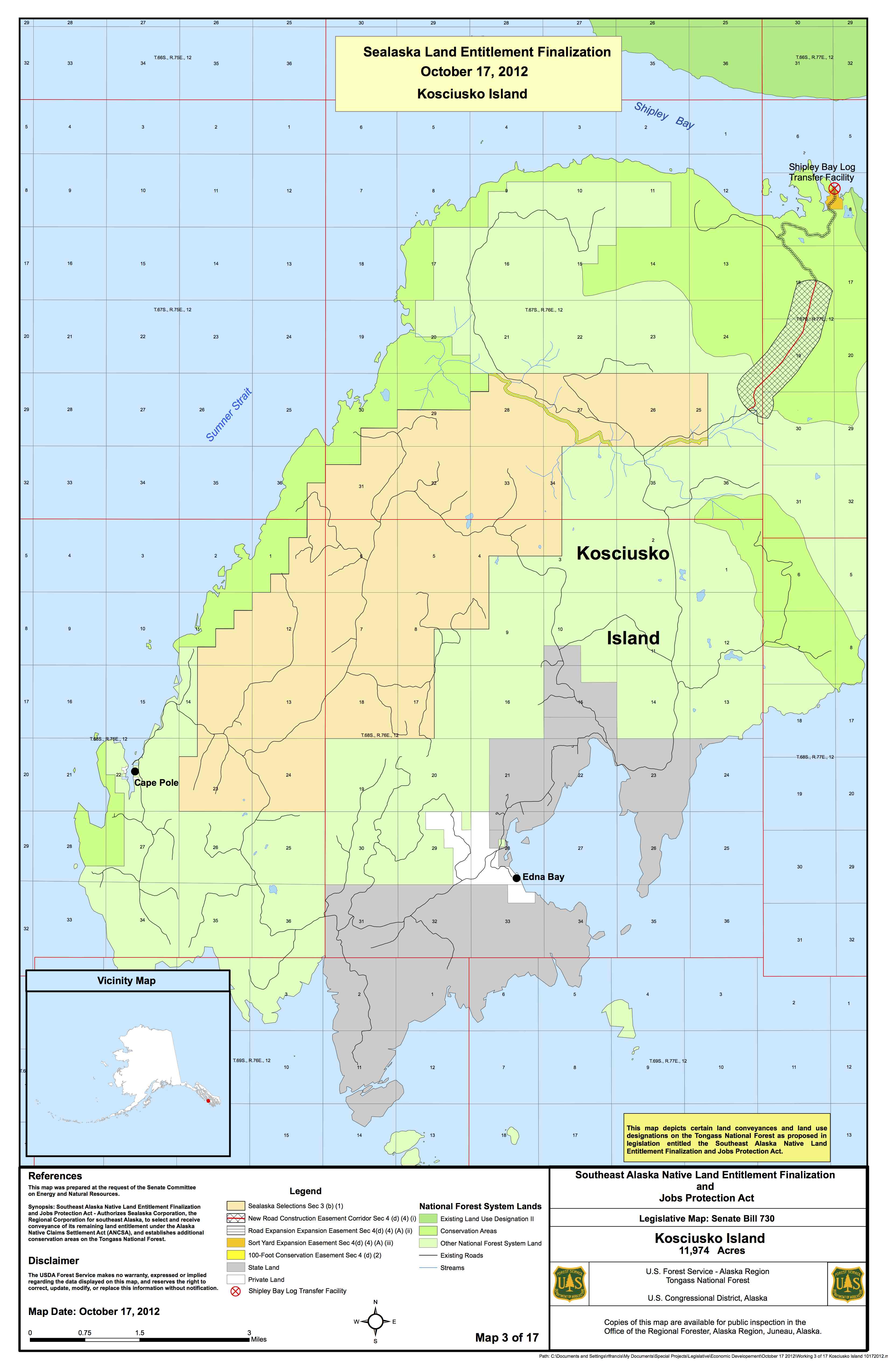
The maps found here show you the specific 8 SELECTIONS Sealaska requested in S 730.
All of these selections are outside of the 1975 boxes illustrated above.
These maps (click here) were done by the Forest Service more than a year ago, yet Lisa Murkowski posted different maps on her Senate Web site a little while later that did not show the size of the trees per acre or the volume of timber per acre. She has had a year and a half to update her maps and has not. This is not telling the whole truth.
As of May, 2012, the maps we posted here are still the official USFS maps for Senate bill S 730.
You can click on the maps and see the dark green. Each square on the map represents 1 square mile. The dark green represents a Manhatten sized area, and is made up of the highest value timber. The definition of high-grading is an amount out of proportion to the average in the forest. These dark green areas are off-the-chart high grading. Only powerful political forces would have the arrogance to cherry pick so much.
Why is that important?
· Because Sealaska is high grading the very best timber.
· Murkowski’s maps don’t show the high grading.
· The USFS maps prove this is a Land Grab.
· Because many of these selections on the islands where we live will
have powerful negative impacts upon our jobs.
A year after the the USFS did their maps, a report came out. This 2012 report demonstrated Sealaska was cherry picking the very best of the biggest trees.
The largest trees are rare. Yet Sealaska is taking 11-1200% more of the largest class 7 trees than exist in the whole forest. By large we mean 7-12 feet in diameter.
Some of the people living in our towns were uprooted when the spotted owl was listed as endangered. On our island, something called the Alexander Archipelego Wolf could also be listed if Sealaska gets these big trees which were reserved to protect the wolf. That will ruin our lives.
Sealaska got a deal for 7.8 billion board feet in 1975. They have taken 7.7 billion. The lands in the box are perfectly economic to log. Sealaska is entitled to a certain amount of land in boxes established in 1975, not to the very best timber in the Tongass. Sealaska should stop trying to renegotiate a 40 year old deal with the American people. This battle should end with Sealaska taking the 1975 selections.
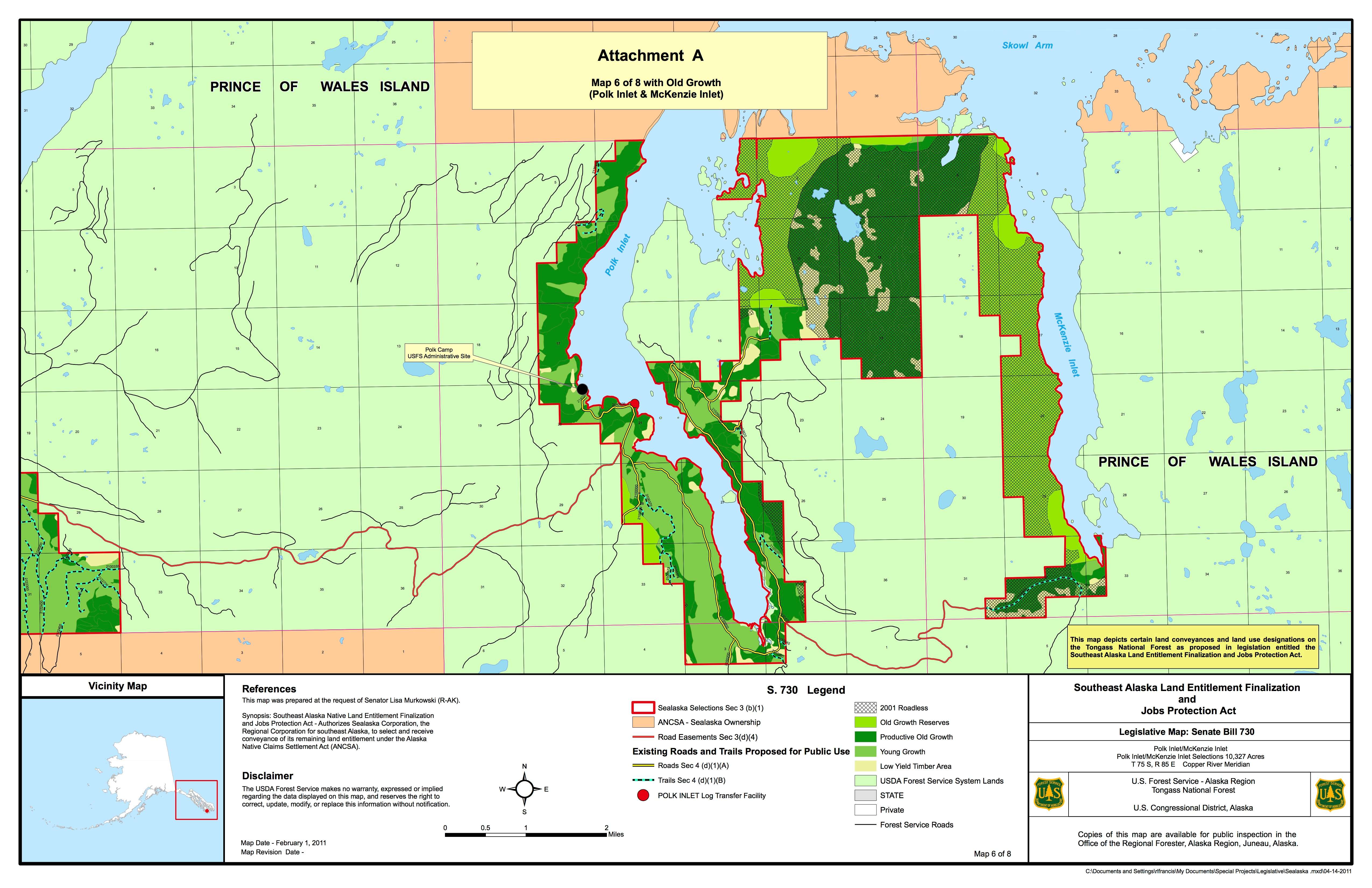
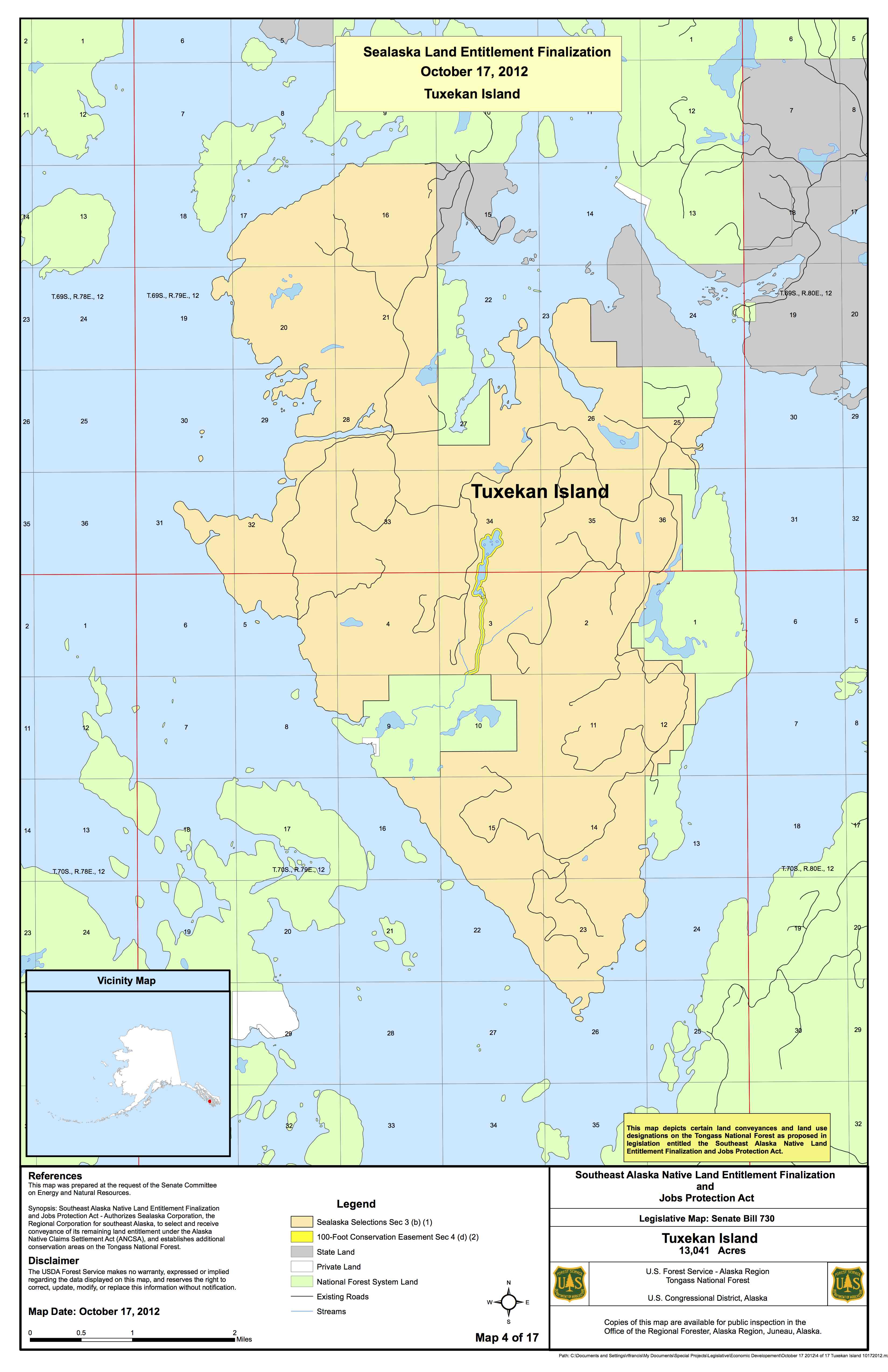
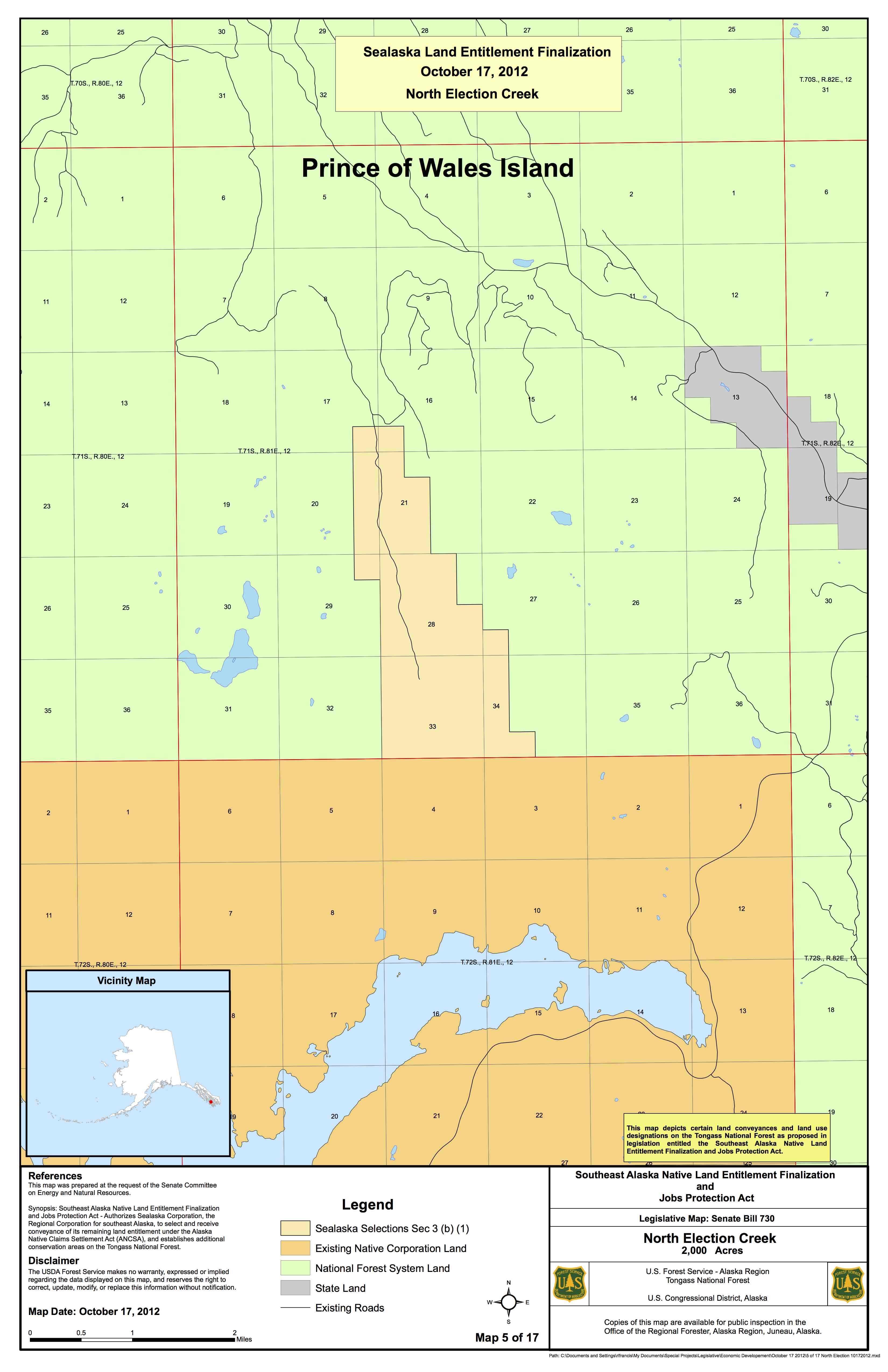
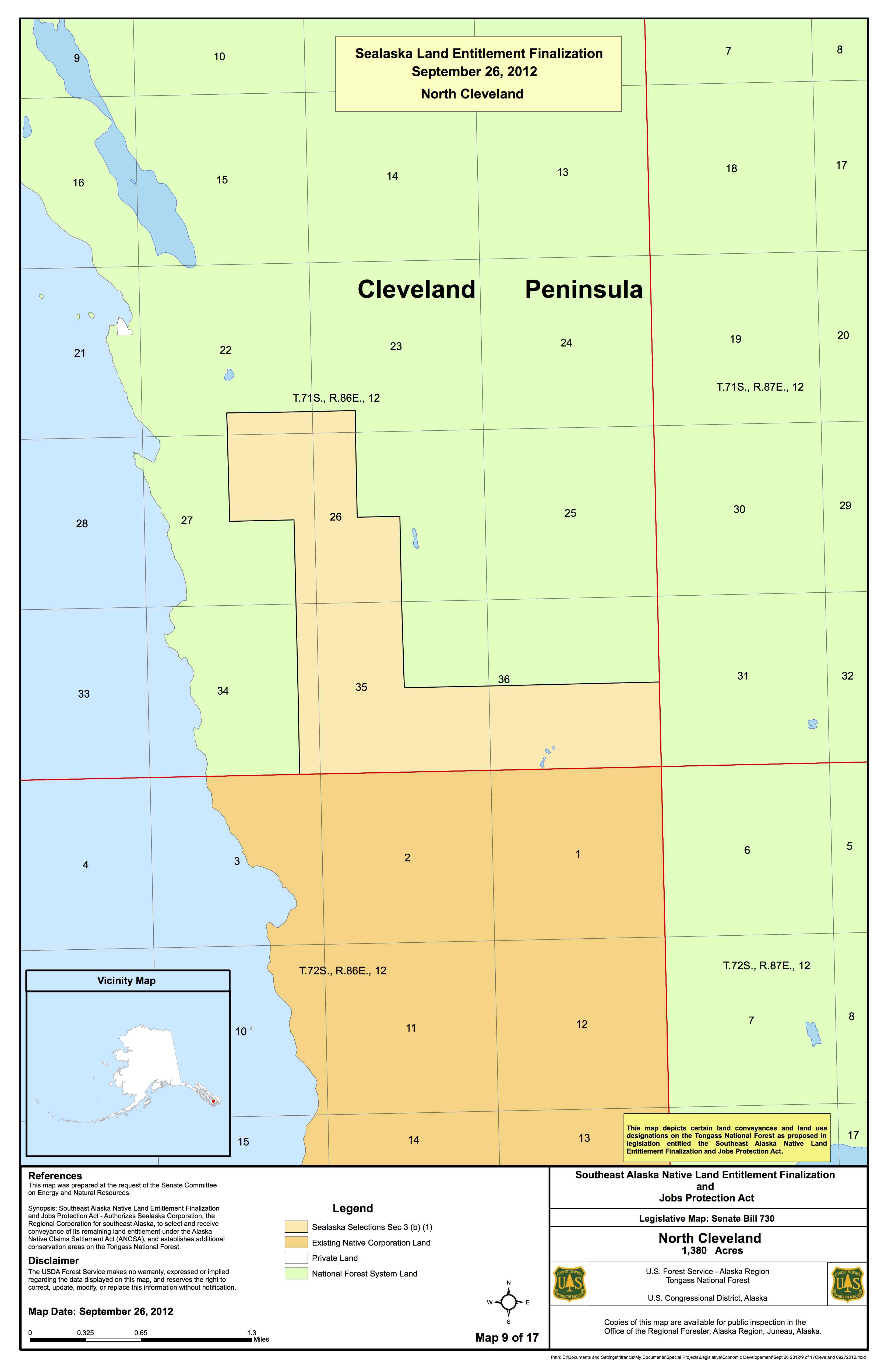
2011 USFS Maps Show Old Growth and Roadless Areas for Sealaska's Out of Box Selections
In 2013, Murkowski's October 2012 Maps Do Not Show Roadless or Old Growth
Murkowski argues that the out of box selections are better, because her web site maps that we have put up here do not show how much of the out of box selections are big old growth (good wildlife habitat) or roadless.
Compare the USFS maps from 2011 to Murkowski's Oct 2012 maps to see Sealaska is taking roadless and much old growth in the out of box selections.
In S. 14, the North Election Selection, there are large stands of old growth and roadless that Sealaska would get. The Polk selection also has square miles of large old growth.


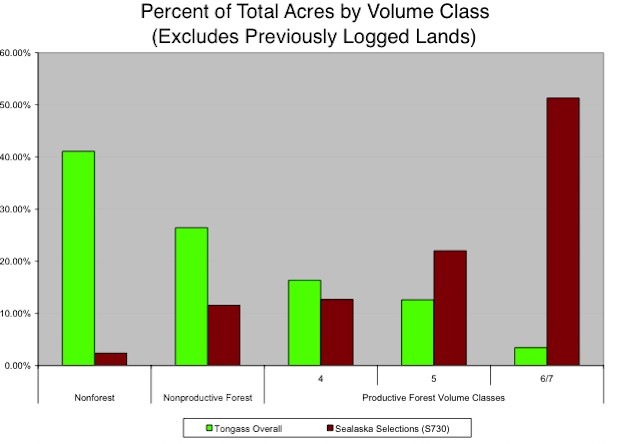
This graph compares the acres by volume of timber between S 730 selections (Purple) and the overall Tongass forested acres (Green) but excludes logged acres (and there are many hundreds of thousands of logged acres).
- The green bars represent the whole Tongass National Forest which is 16.8 million acres.
- Much is non forest ---- glaciers, mountain tops, steep mountain side.
- About 32% of the Tongass is forest, but not all acres of the forest are the same.
- Some old growth acres have big trees, some small. If an acre has a lot of big trees, the volume per acre is larger.
- The US Forest Service made Class 7 the one with the highest volume (and biggest trees, some twelve feet in diameter and 250 feet high).
- The next highest volume per acre is Class 6 and so on down to Class 4.
- No more than three percent of the Tongass was in Class 7 before industrial logging began in the 1950s.
- Estimates on how much class 7 is left vary, but it is now certainly less than half of the original and so class 7 is rare and important to maintaining healthy populations of wildlife.
- Compare the Class 6-7 bar in green to the Sealaska selection in purple.
- Class 6-7 is not only the most valuable timber land, it is also the most important wildlife habitat.
- In S 730, it is clear Sealaska chose 40 times more of the biggest remaining trees proportionately than exists in the Tongass as a whole. This choice is called high grading, cherry picking, or just plain taking the most of the best.
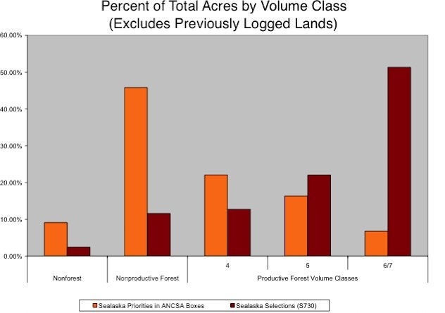
This graph compares the volume class between the land Sealaska wanted inside the ANCSA boxes (Orange) to the land it now wants in S 730 (Purple). These acres are only for those not yet logged.
Sealaska wants many more high volume acres in S 730 than it chose in the ANCSA boxes.
- In S 730, Sealaska wants forest land whose composition is more than 52% of Class 6-7.
- But in ANSCA it asked for acres that had only about 5% of class 6/7.
- 5% of Class 6-7 is almost double the percentage of the remaining large tree stands on the whole Tongass.
- Both class 5 and 4 have volumes economic to log on the forest.
- The Class 4 & 5 percentages in both the ANSCA request in the box and in S 730 are roughly the same.
- It is clear, Sealaska’s 2008 BLM in the box selections are economical to log.
- It is also clear Sealaska wants the most valuable lands left in the Tongass.
Volume class 3= 0-8 mbf /ac.
VC4= 8-20mbf,
VC5= 20-30 mbf,
VC6= 30-50 mbf, and
VC7 is about 60 mbf/ ac
(from metadata from 1997 TLMP)
PLEASE CONTRIBUTE TODAY
FIGHTING COSTS ALOT. WE NEED YOUR HELP TODAY.